Development Committee
Meeting Date: Tuesday,
06 November, 2018
Location: Council
Chambers, City Administrative Building, Bridge Road, Nowra
Time: 5.00pm
Membership (Quorum - 5)
Clr Joanna Gash - Chairperson
Clr Greg Watson – Deputy Chairperson
All Councillors
General Manager or nominee
Please note: The proceedings of this meeting
(including presentations, deputations and debate) will be webcast and may be
recorded and broadcast under the provisions of the Code of Meeting Practice. Your attendance at this meeting is taken
as consent to the possibility that your image and/or voice may be recorded and
broadcast to the public.
Agenda
1. Apologies / Leave of Absence
2. Confirmation of Minutes
· Development
Committee - 11 September 2018.......................................................... 1
3. Declarations of Interest
4. Mayoral Minute
5. Deputations and Presentations
6. Notices of Motion / Questions on Notice
Notices of Motion / Questions on Notice
DE18.68...... Notice of Motion - DA18/1998 - 64 Seagrass Avenue
Bayswood (Vincentia) 10
7. Reports
Planning Environment & Development
DE18.69...... Exhibition Outcomes and Next Steps - Proposed
Interim Policy - Development Adjoining Narrow Laneways across Shoalhaven......................................... 11
DE18.70...... Exhibition Outcomes and Proposed Finalisation -
Review of LEP and DCP Flood Controls........................................................................................................ 24
DE18.71...... Draft Planning Agreement – Lot 172 DP
755923 and Lot 823 DP 247285 Berringer Rd, Cunjurong Point Rd and Sunset
Strip Manyana.................................. 38
DE18.72...... Development Application – 54 Eastbourne
Ave, Culburra Beach – Lot 494 DP 12278...................................................................................................................... 54
DE18.73...... Exhibition Outcomes - Draft Planning Proposal
Guidelines 2018............... 68
8. Confidential
Reports
Nil
|

|
Development
Committee – Tuesday 06 November 2018
Page
iii
|
Development Committee
Delegation:
Pursuant to
s377 (1) of the Local Government Act 1993 the Committee is delegated the
functions conferred on Council by the Environmental Planning & Assessment
Act 1979 (EPA Act), Local Government Act 1993 (LG Act) or any other Act or
delegated to Council, as are specified in the attached Schedule, subject to the
following limitations:
i. The
Committee cannot make a decision to make a local environmental plan to classify
or reclassify public land under Division 1 of Part 2 of Chapter 6 of the LG
Act;
ii.
The Committee cannot review a section 8.11 or
section 8.9 EPA Act determination made by the Council or by the Committee
itself;
iii.
The Committee cannot exercise any function delegated
to the Council which by the terms of that delegation cannot be sub-delegated;
iv.
The Committee cannot exercise any function which
s377(1) of the LG Act provides cannot be delegated by Council; and
v.
The Committee cannot exercise a function which
is expressly required by the LG Act or any other Act to be exercised by
resolution of the Council.
Schedule
a. All
functions relating to the preparation, making, and review of local
environmental plans (LEPs) and development control plans (DCPs) under Part 3 of
the EPA Act.
b. All
functions relating to the preparation, making, and review of contributions
plans and the preparation, entry into, and review of voluntary planning
agreements under Part 7 of the EPA Act.
c. The
preparation, adoption, and review of policies and strategies of the Council in
respect of town planning and environmental matters and the variation of such
policies.
d. Determination
of variations to development standards related to development applications
under the EPA Act where the development application involves a development
which seeks to vary a development standard by more than 10% and the application
is accompanied by a request to vary the development standard under clause 4.6
of Shoalhaven Local Environmental Plan 2014 or an objection to the application
of the development standard under State Environmental Planning Policy No. 1
– Development Standards.
e. Determination
of variations from the acceptable solutions and/or other numerical standards
contained within the DCP or a Council Policy that the General Manager requires
to be determined by the Committee
f. Determination
of development applications that Council requires to be determined by the
Committee on a case by case basis.
g. Review
of determinations of development applications under sections 8.11 and 8.9 of
the EP&A Act that the General Manager requires to be determined by the
Committee.
h. Preparation,
review, and adoption of policies and guidelines in respect of the determination
of development applications by other delegates of the Council.
Minutes of the Development Committee
Meeting Date: Tuesday,
11 September 2018
Location: Council
Chambers, City Administrative Building, Bridge Road, Nowra
Time: 5.00pm
The following members
were present:
Clr Joanna Gash -
Chairperson
Clr Amanda Findley
Clr Patricia White
Clr John Wells
Clr Nina Cheyne
Clr Kaye Gartner
Clr Mitchell Pakes (left
5.49pm)
Clr Greg Watson
Clr Bob Proudfoot
Mr Russ Pigg - General
Manager
|
Apologies / Leave of Absence
|
Apologies were received
from Clrs Alldrick, Levett, Kitchener and Guile.
|
Confirmation of the Minutes
|
|
RESOLVED (Clr White / Clr Cheyne)
MIN18.690
That the Minutes of the
Development Committee held on Tuesday 14 August 2018 be confirmed.
CARRIED
|
Nil.
Deputations and Presentations
DE18.61 - Exhibition Outcomes
and Next Steps – Nowra Riverfront Entertainment and Leisure Precinct -
Proposed Planning Controls Report
Johny Vynes spoke for the
recommendation.
DE18.63 Berry Heritage Investigation Project - Future
Direction
Catherine Barlow, representing
the Berry & District Historical Society, spoke for the recommendation.
DE18.64
South Nowra Industrial Zoned Area - Future Direction
Rodney Foyel,
representing South Nowra Disadvantaged Landholders, spoke against the
recommendation.
DE18.67
DA18/1788 – 128 Princes Highway SOUTH NOWRA - Lot 25 DP 734975
Lee
Carmichael, PDC Planners, spoke against the recommendation.
Reports
|
Introduction of Items as
Matters of Urgency
|
|
RESOLVED (Clr Pakes / Clr Wells) MIN18.691
That
the following addendum reports be introduced as matters of urgency:
1. DE18.67 DA18/1788
– 128 Princes Highway SOUTH NOWRA - Lot 25 DP 734975
CARRIED
|
|
The Chairperson ruled the matters
as ones of urgency as they relate to urgent business of Council and allowed
their introduction.
|
|
Procedural
Motion - Bring Item Forward
|
|
RESOLVED (Clr Pakes / Clr Wells) MIN18.692
That items DE18.67, DE18.61,
DE18.63 and DE18.64 be brought forward for consideration.
CARRIED
|
|
DE18.67 DA18/1788
– 128 Princes Highway SOUTH NOWRA - Lot 25 DP 734975
|
HPERM Ref:
D18/305499
|
|
Recommendation (Item to be determined under
delegated authority)
That Council:
1. Support
the variation to Acceptable Solution A1.6 of Chapter G22: Advertising Signs
and Structures as it relates to Development Application No. DA18/1788 for the
installation of two (2) additional free-standing business identification
signs in association with an approved vehicle sale or hire premises (motor
vehicle showroom) at 128 Princes Highway, South Nowra - Lot 25 DP 734975,
subject to compliance with the revised location of free-standing signage
indicated in the part site plan provided as Figure 6 of this Council
Report; and
2. Refer
the application back to staff for determination.
|
|
RESOLVED (Clr Proudfoot / Clr
Wells) MIN18.693
That Council supports the
variations of Acceptable Solutions of Chapter G22: Advertising Signs and
Structures as proposed by the applicant in its supporting site plan.
For: Clr
Gash, Clr Findley, Clr White, Clr Wells, Clr Cheyne, Clr Gartner, Clr Pakes,
Clr Watson, Clr Proudfoot and Russ Pigg
Against: Nil
CARRIED
|
Note: Clr Pakes left the
meeting, the time being 5.49pm.
|
DE18.61 Exhibition
Outcomes and Next Steps - Nowra Riverfront Entertainment and Leisure Precinct
- Proposed Planning Controls Report
|
HPERM Ref:
D18/218690
|
|
Recommendation (Item to be determined under
delegated authority)
That Council:
1. Endorse
the Nowra Riverfront Leisure and Entertainment Precinct Strategic Direction:
Review & Analysis and Proposed Planning Controls Reports as exhibited and
with the following changes to the Proposed Planning Controls Report:
a. Amend
the Indicative Future Road Local / Alignment on the key development
parameters mapping including the closure of Pleasant Way as per Variation B
of the report and illustrate an additional road connection off Hawthorn
Avenue to Princes Highway.
b. Include
further justification for the change in Land Use Zone and Height of Building
in Scenic Drive, Wharf Road, Bridge Road and Pleasant Way and Graham Lodge
sub-precincts in accordance with Section 9.1 Ministerial Direction 1.1
Business and Industrial Zones and 3.1 Residential Zones.
c. Amend
the Bridge Road and Scenic Drive sub-precincts to include additional text
which notes that the future development of these sub-precincts will be
subject to additional investigation once the detail design of the Nowra
Bridge project is complete.
d. Amend
Figure 43 and supporting text to categorise Bridge Road sub-precinct as Level
3 high level of uncertainty around the impact to development outcomes as a
result of the acquisition associated with the Nowra Bridge project.
2. Prepare
a Planning Proposal for Mandalay Avenue sub-precinct to amend the Land Use
Zones, Height of Buildings and Floor Space Ratio as per the exhibited
Proposed Planning Controls Report and submit to Department of Planning &
Environment for Gateway determination.
3. Prepare
a Planning Proposal for the remaining sub-precincts as per the Staging Plan
(except for Bridge Road and Scenic Drive sub-precincts) as per the exhibited
Proposed Planning Controls Report and with the following additional
considerations:
a. Reflect
the latest Concept Design for the Nowra Bridge Project.
b. Consider
reduction in Height of Building and Floor Space Ratio to address flooding
impacts.
c. Consider
B4 Mixed Use as an alternative zone for the Wharf Road precinct, and
Additional Permitted Uses to enable the activation of the riverfront.
d. Prior
to submitting to NSW Department of Planning & Environment for Gateway
determination, report the matter to Council.
4. Prepare
a Development Control Plan Chapter to be inserted into Shoalhaven Development
Control Plan 2014 for the Nowra Riverfront Precinct, which includes the controls
in the exhibited Proposed Planning Controls Report as per the Staging Plan
(except for Bridge Road and Scenic Drive), and:
a. In
preparing the Draft Development Control Plan Chapter:
i. Review
appropriateness and suitability of flood related controls.
ii. Revise
the key development parameters of each sub-precinct to reflect the latest
Concept Design for the Nowra Bridge Project.
5. Commence
initial preparatory work to clarify the infrastructure required to support
the future development of the precinct and inform a possible Contributions
Plan Amendment for new road, drainage and open space infrastructure projects
and consider a subsequent report on this aspect that details the funding
required to advance the infrastructure design work and identifies a Council
funding source.
6. Notify
all submitters and public authorities of the resolution.
|
|
RESOLVED (Clr Gartner / Clr
Cheyne) MIN18.694
That Council:
1. Endorse
the Nowra Riverfront Leisure and Entertainment Precinct Strategic Direction:
Review & Analysis and Proposed Planning Controls Reports as exhibited and
with the following changes to the Proposed Planning Controls Report:
a. Amend
the Indicative Future Road Local / Alignment on the key development
parameters mapping including the closure of Pleasant Way as per Variation B
of the report and illustrate an additional road connection off Hawthorn
Avenue to Princes Highway.
b. Include
further justification for the change in Land Use Zone and Height of Building
in Scenic Drive, Wharf Road, Bridge Road and Pleasant Way and Graham Lodge
sub-precincts in accordance with Section 9.1 Ministerial Direction 1.1
Business and Industrial Zones and 3.1 Residential Zones.
c. Amend
the Bridge Road and Scenic Drive sub-precincts to include additional text
which notes that the future development of these sub-precincts will be
subject to additional investigation once the detail design of the Nowra
Bridge project is complete.
d. Amend
Figure 43 and supporting text to categorise Bridge Road sub-precinct as Level
3 high level of uncertainty around the impact to development outcomes as a
result of the acquisition associated with the Nowra Bridge project.
2. Prepare
a Planning Proposal for Mandalay Avenue sub-precinct to amend the Land Use
Zones, Height of Buildings and Floor Space Ratio as per the exhibited
Proposed Planning Controls Report and submit to Department of Planning &
Environment for Gateway determination.
3. Prepare
a Planning Proposal for the remaining sub-precincts as per the Staging Plan
(except for Bridge Road and Scenic Drive sub-precincts) as per the exhibited
Proposed Planning Controls Report and with the following additional
considerations:
a. Reflect
the latest Concept Design for the Nowra Bridge Project.
b. Consider
reduction in Height of Building and Floor Space Ratio to address flooding
impacts.
c. Consider
B4 Mixed Use as an alternative zone for the Wharf Road precinct, and
Additional Permitted Uses to enable the activation of the riverfront.
d. Prior
to submitting to NSW Department of Planning & Environment for Gateway
determination, report the matter to Council.
4. Prepare
a Development Control Plan Chapter to be inserted into Shoalhaven Development
Control Plan 2014 for the Nowra Riverfront Precinct, which includes the
controls in the exhibited Proposed Planning Controls Report as per the
Staging Plan (except for Bridge Road and Scenic Drive), and:
a. In
preparing the Draft Development Control Plan Chapter:
i. Review
appropriateness and suitability of flood related controls.
ii. Revise
the key development parameters of each sub-precinct to reflect the latest
Concept Design for the Nowra Bridge Project.
5. Commence
initial preparatory work to clarify the infrastructure required to support
the future development of the precinct and inform a possible Contributions
Plan Amendment for new road, drainage and open space infrastructure projects
and consider a subsequent report on this aspect that details the funding
required to advance the infrastructure design work and identifies a Council
funding source.
6. Notify
all submitters and public authorities of the resolution.
For: Clr
Gash, Clr Findley, Clr White, Clr Wells, Clr Cheyne, Clr Gartner, Clr
Proudfoot and Russ Pigg
Against: Clr
Watson
CARRIED
|
|
DE18.63 Berry
Heritage Investigation Project - Future Direction
|
HPERM Ref:
D18/261051
|
|
Recommendation (Item
to be determined under delegated authority)
That Council:
1. Proceed
with the Berry Heritage Investigations project; to investigate and consider
the 29 properties and 2 smaller Heritage Conservation Areas identified as
possible additional heritage listings for Berry.
2. Commit
to the direct funding of the project (approximately $40,000) via savings from
the quarterly budget review.
3. Notify
relevant stakeholders, including the Berry Forum, of this decision and how
they can be involved as the project progresses.
|
|
RESOLVED (Clr Wells / Clr White) MIN18.695
That Council:
1. Proceed
with the Berry Heritage Investigations project; to investigate and consider
the 29 properties and 2 smaller Heritage Conservation Areas identified as
possible additional heritage listings for Berry.
2. Refer
the matter of funding for The Berry Heritage Investigations Project for
consideration (approximately $40,000) in the next quarterly budget review
report to Council.
3. Notify
relevant stakeholders, including the Berry Forum, of this decision and how
they can be involved as the project progresses.
For: Clr
Gash, Clr Findley, Clr White, Clr Wells, Clr Cheyne, Clr Gartner, Clr Watson,
Clr Proudfoot and Russ Pigg
Against: Nil
CARRIED
|
|
DE18.64 South
Nowra Industrial Zoned Area - Future Direction
|
HPERM Ref:
D18/273390
|
|
Recommendation (Item to be determined under
delegated authority)
That Council
1. Receive
the report on the representations made by landowners in South Nowra
Industrial Zoned Area for information.
2. Engage
a suitably qualified and experienced consultant/s to assist Council with the
preparation of proposed development controls and engineering design
investigations for required access roads, drainage infrastructure, land
acquisition and water/sewerage in the South Nowra Industrial Zoned Area.
3. Support
the preparation of an area specific chapter for South Nowra Industrial Zoned
Area in Shoalhaven Development Contribution Plan (DCP) 2014.
4. Support
the preparation of an amendment to Shoalhaven Contributions Plan (CP) 2010 to
include additional Local Contribution Projects to facilitate required
infrastructure works and recoup design and investigation costs.
5. Receive
a future report to consider the draft DCP Chapter and draft CP amendment for
South Nowra Industrial Zoned Area for public exhibition.
|
|
RESOLVED (Clr Findley / Clr
Proudfoot) MIN18.696
That
Council
1. Receive
the report on the representations made by landowners in South Nowra
Industrial Zoned Area for information.
2. Engage
a suitably qualified and experienced consultant/s to assist Council with the
preparation of proposed development controls and engineering design investigations
for required access roads, drainage infrastructure, land acquisition and
water/sewerage in the South Nowra Industrial Zoned Area.
3. Support
the preparation of an area specific chapter for South Nowra Industrial Zoned
Area in Shoalhaven Development Contribution Plan (DCP) 2014.
4. Support
the preparation of an amendment to Shoalhaven Contributions Plan (CP) 2010 to
include additional Local Contribution Projects to facilitate required
infrastructure works and recoup design and investigation costs.
5. Receive
a future report to consider the draft DCP Chapter and draft CP amendment for
South Nowra Industrial Zoned Area for public exhibition.
6. Directs
the General Manager to prepare a planning proposal and submit it for Gateway
determination seeking to confirm and establish a dwelling entitlement on each
of the individual properties within the industrially zoned area.
7. Receive
an additional report from the General Manager (Economic Development) on the
business case of the proposition of the land bank of future industrial land.
For: Clr
Gash, Clr Findley, Clr White, Clr Wells, Clr Cheyne, Clr Gartner, Clr Watson
and Clr Proudfoot
Against: Russ
Pigg
CARRIED
|
|
DE18.61 Exhibition
Outcomes and Next Steps - Nowra Riverfront Entertainment and Leisure Precinct
- Proposed Planning Controls Report
|
HPERM Ref: D18/218690
|
|
Item
dealt with earlier in the meeting see MIN18.694.
|
|
DE18.62 Exhibition
Outcomes - Planning Proposal - 9 Browns Road South Nowra - Caravan Park
|
HPERM Ref:
D18/228829
|
|
Recommendation (Item to be determined under
delegated authority)
That the Committee:
1. Adopt
the Planning Proposal PP034 as exhibited, with the minor adjustments detailed
in the report, to make ‘caravan parks’ an additional permitted
use at Lot 1 DP 1079345, 9 Browns Road South Nowra.
2. Forward
Planning Proposal (PP034) to NSW Parliamentary Counsel’s Office to
draft the required amendment to Shoalhaven Local Environmental Plan 2014.
3. Make
the resulting amendment to the Shoalhaven Local Environmental Plan 2014 using
the plan making delegations issued under Section 2.4 of the NSW
Environmental Planning and Assessment Act 1979.
4. Notify
the proponent, submitters and residents of the site when the amendment of
Shoalhaven Local Environmental Plan 2014 is notified.
|
|
RESOLVED (Clr Findley / Clr
Wells) MIN18.697
That the Committee:
1. Adopt
the Planning Proposal PP034 as exhibited, with the minor adjustments detailed
in the report, to make ‘caravan parks’ an additional permitted
use at Lot 1 DP 1079345, 9 Browns Road South Nowra.
2. Forward
Planning Proposal (PP034) to NSW Parliamentary Counsel’s Office to
draft the required amendment to Shoalhaven Local Environmental Plan 2014.
3. Make
the resulting amendment to the Shoalhaven Local Environmental Plan 2014 using
the plan making delegations issued under Section 2.4 of the NSW
Environmental Planning and Assessment Act 1979.
4. Notify
the proponent, submitters and residents of the site when the amendment of
Shoalhaven Local Environmental Plan 2014 is notified.
For: Clr
Gash, Clr Findley, Clr White, Clr Wells, Clr Cheyne, Clr Gartner, Clr Watson,
Clr Proudfoot and Russ Pigg
Against: Nil
CARRIED
|
|
DE18.63 Berry Heritage Investigation Project - Future Direction
|
HPERM Ref: D18/261051
|
|
Item
dealt with earlier in the meeting see MIN18.695.
|
|
DE18.64 South Nowra Industrial Zoned Area - Future Direction
|
HPERM Ref: D18/273390
|
|
Item
dealt with earlier in the meeting see MIN18.696.
|
|
DE18.65 Low
Rise Medium Density Housing Code - Request for Deferred Commencement
Extension
|
HPERM Ref:
D18/279418
|
|
Recommendation (Item
to be determined under delegated authority)
That Council:
1. Submit
the correspondence at Attachment 1 to the Department of Planning and
Environment, requesting up to a further 12-month deferral (until 30 June
2020) for Shoalhaven in relation to the Low Rise Medium Housing Code.
2. Advise
Development Industry Representatives and Community Consultative Bodies of
this resolution, and again should Council be successful in obtaining the
further 12-month extension.
|
|
RESOLVED (Clr Findley / Clr
White) MIN18.698
That Council:
1. Submit
the correspondence at Attachment 1 to the Department of Planning and
Environment, requesting up to a further 12-month deferral (until 30 June
2020) for Shoalhaven in relation to the Low Rise Medium Housing Code.
2. Advise
Development Industry Representatives and Community Consultative Bodies of
this resolution, and again should Council be successful in obtaining the
further 12-month extension.
For: Clr
Gash, Clr Findley, Clr White, Clr Wells, Clr Cheyne, Clr Gartner, Clr Watson,
Clr Proudfoot and Russ Pigg
Against: Nil
CARRIED
|
|
DE18.66 Proposed
2017 Housekeeping Amendment to Shoalhaven Local Environmental Plan 2014 -
Instrument Changes
|
HPERM Ref:
D18/282538
|
|
Recommendation (Item to be determined under
delegated authority)
That Council:
1. Submit
the 2017 Housekeeping Amendment – Instrument Changes Planning Proposal
(PP033 – Attachment 1) to the NSW Department of Planning and
Environment for a Gateway determination and if favourable, proceed to formal
public consultation in accordance with the terms of the determination.
2. Advise
any relevant community groups of this decision, noting the opportunity for
formal consultation later in the process.
|
|
RESOLVED (Clr Wells / Clr
Gartner) MIN18.699
That Council:
1. Submit
the 2017 Housekeeping Amendment – Instrument Changes Planning Proposal
(PP033 – Attachment 1) to the NSW Department of Planning and
Environment for a Gateway determination and if favourable, proceed to formal
public consultation in accordance with the terms of the determination.
2. Advise
any relevant community groups of this decision, noting the opportunity for
formal consultation later in the process.
For: Clr
Gash, Clr Findley, Clr White, Clr Wells, Clr Cheyne, Clr Gartner, Clr Watson,
Clr Proudfoot and Russ Pigg
Against: Nil
CARRIED
|
Addendum Reports
|
DE18.67 DA18/1788
– 128 Princes Highway SOUTH NOWRA - Lot 25 DP 734975
|
HPERM Ref: D18/305499
|
|
Item
dealt with earlier in the meeting see MIN18.693.
|
There being no further
business, the meeting concluded, the time being 6.36pm.
Clr Gash
CHAIRPERSON
|

|
Development
Committee – Tuesday 06 November 2018
Page
0
|
DE18.68 Notice
of Motion - DA18/1998 - 64 Seagrass Avenue Bayswood (Vincentia)
HPERM Ref: D18/377205
Submitted
by: Clr John Levett
Purpose / Summary
The following Notice of Motion,
of which due notice has been given, is submitted for Council’s
consideration.
|
Recommendation (Item to be
determined under delegated authority)
That DA18/1998 at 64 Seagrass
Avenue, Bayswood be called in for consideration by Council. There have
been around 30 objections to this development and the application has caused
considerable public concern. And also that Council Staff organise a
public briefing to allay the fears of Bayswood residents that this proposed
development is not in accordance with the original Bayswood Masterplan and
that it contravenes Dual Occupancy Guidelines and relevant Development
Control Plans.
|
Background
64 Seagrass Avenue, Bayswood
(Lot 1138 in DP 1210394) is a 500 sq mtr block in an R2 Zone. The DA is
for a detached dual occupancy totalling 9 bedrooms, 2 single garages and 2
parking spaces. Parking in Seagrass Avenue is already inadequate on a main
access 6 metre wide carriageway. The proposal is out of character with existing
Bayswood accommodation which is single dwellings.
|
|
Development
Committee – Tuesday 06 November 2018
Page
0
|
DE18.69 Exhibition
Outcomes and Next Steps - Proposed Interim Policy - Development Adjoining
Narrow Laneways across Shoalhaven
HPERM Ref: D18/233210
Group: Planning
Environment & Development Group
Section: Strategic
Planning
Attachments: 1. Submission
Summary - Laneways by Suburb (under separate cover) ⇨
2. Proposed
Interim Policy - Development Adjoining Narrow Laneways ⇩
3. Review of Other Councils'
Policies - Case Studies of Ballina, Newcastle and Randwick ⇩
Purpose / Summary
· Detail
the outcomes of the public exhibition of the proposed Interim Policy for
Development Adjoining Narrow Laneways and seek Council adoption of an Interim
Policy; and
· Commence
the process to prepare a future amendment to Shoalhaven Development Control
Plan (DCP) 2014 in relation to development adjoining narrow laneways.
|
Recommendation (Item to be
determined under delegated authority)
That Council
1. Adopt
the Interim Policy – Development Adjoining Narrow Laneways as amended
to apply to secondary access lanes only, provided in Attachment 1.
2. Apply
the Interim Policy until Shoalhaven Development Control Plan 2014 has been
amended to include development controls for development adjoining and
fronting onto narrow laneways.
3. Prepare
a draft amendment to Shoalhaven Development Control Plan 2014 to insert
specific development controls for development adjoining narrow laneways in
residential zones for Council consideration prior to proceeding to
exhibition.
4. Notify
those people who provided a submission of this resolution.
|
Options
1. Adopt the
recommendation to establish an interim policy position in relation to
development adjoining narrow laneways and prepare a draft amendment to
Shoalhaven DCP 2014 for Council consideration via a subsequent report.
Implications: This is the preferred option, as it
will help mitigate/manage future ad-hoc development outcomes occurring along
narrow laneways. The recommendation means that in the interim,
development will generally not be supported where laneways are less than 10m
wide, and where greater than 10m, the development must result in minimal impact
on existing residential amenity and be adequately serviced.
The option will also enable Council to commence the
preparation of an amendment to Shoalhaven DCP 2014 to ultimately insert
specific development controls for development adjoining narrow laneways in
residential zones.
2. Adopt an
alternative recommendation.
Implications: Depending on the nature, this
recommendation this could create certain risks, including the potential for
further uncontrolled development along laneways.
3. Not adopt the
recommendation.
Implications: This is not preferred. Council does
not currently have a policy position on developments that propose to utilise
rear laneways for primary vehicular access and frontage.
Approval of individual Development Applications
(DA’s) along the laneways without first establishing a policy position
could result in uncontrolled and inconsistent development along the narrow
laneways, with potentially detrimental impacts on existing infrastructure and
neighbourhood amenity.
Background
There are over 8,750 metres of
“laneways” throughout the Shoalhaven Local Government Area.
Ninety per cent (90%) of these laneways have a road reserve width (property
boundary to boundary) of less than 10m. At present, most narrow laneways
are used for secondary access to detached garages/outbuildings, or for direct
rear-yard access for the parking of boats, caravans, and the like. This use is
a mix of formal and informal.
Increasing development pressure
has seen an increase in the number of applications and future interest from
property owners for subdivision and dual occupancy development fronting onto
narrow laneways. Council does not currently have specific development
controls to effectively manage or consider this type of development.
On 13 March 2018 the Development
Committee considered a report identifying the current and emerging issues
associated with development adjoining narrow laneways. The report was
prompted following the lodgement of two development applications (DA’s)
in Culburra Beach which sought to utilise Allerton Lane as a primary frontage
for future development.
As a result of the report it was
resolved:
That Council
1. Establish an
‘interim’ policy position in relation to development on narrow laneways in Shoalhaven that includes:
a. Laneways are not to be used as primary frontages.
b. Development proposals to increase vehicular access and
servicing along narrow laneways that have a road reserve width of less than 10m,
are generally not supported. Intensification of lots with rear lane access
would need to propose access and servicing from the primary street.
c. Development proposals to increase vehicular access and
servicing along laneways that have a road reserve width of 10m or greater may
be supported where Council can be satisfied that:
i. The development results in minimal impact on existing
residential amenity, and
ii. Provision of infrastructure, car parking and waste
collection is adequate to facilitate the development.
d. Where an Area Specific Development Control Plan Chapter
exists, it prevails over the interim policy position.
e. That the interim policy be advertised for a period of 30
days, and if no submissions are received, the policy be adopted. If submissions
are received, that the policy be reported to Council prior to adoption.
2. Undertake a review of Shoalhaven
Development Control Plan 2014 to:
a.
Identify any gaps in planning policy in relation to development in laneways.
b.
Prepare development controls that may allow for sympathetic infill development
or increased densities in certain laneways across Shoalhaven consistent with
Council’s adopted policy decision.
3.
Receive a further report to endorse the reviews to Shoalhaven Development
Control Plan 2014, prior to public exhibition.
This report provides the results
of the public exhibition and seeks a resolution to adopt the interim policy and
prepare an amendment to Shoalhaven DCP 2014 to insert new development controls
for consideration in development adjoining or fronting on to narrow laneways
across Shoalhaven.
Community Consultation
In accordance with the
resolution, the proposed interim policy was advertised for a period of 30 days,
from 11 April until 11 May 2018, inclusive. A copy of the proposed
interim policy and explanatory statement were available at Council’s
Administrative Centre, Ulladulla Branch Office and on Council’s website.
In addition to newspaper and
online advertising, Council wrote directly to over 650 landowners adjoining a
narrow laneway, including a survey with the following questions:
1. Do you
support the proposed interim policy? (Yes / No / In part)
2. Explanation of
reasons / any other comments.
A total of 92 submissions were received, including 39 hard
copy surveys, 36 online surveys and 17 written submissions. Most
submissions related specifically to the laneway adjoining the submitter’s
property, rather than the overall proposed interim policy. As such, the
submissions summary that is provided in Attachment 1 is broken up by
suburb and laneway.
It is noted that some
submitter’s comments contradicted their response to Question 1 of the
survey, however the general response from the survey on the proposed interim
policy is summarised below:
|
Do you support the
proposed interim policy?
|
Responses
|
Percentage
|
|
Yes
|
36
|
39%
|
|
No
|
42
|
46%
|
|
In part
|
12
|
13%
|
|
Other
|
2
|
2%
|
It is noted that there was no clear
consensus in terms of support or opposition to the proposed interim policy.
Submissions Overview
The following is an overview of
the matters commented on in submissions and Council staff comments where necessary/appropriate.
1. Impact
on Existing Arrangements
Some submissions raised concern
that the proposed interim policy would impact on, or revoke existing access
arrangements, development consents, or servicing relating to development
adjacent to laneways.
Staff Comment
The proposed interim policy
would have no effect on existing informal or formal access arrangements,
development consents or servicing in laneways. It is aimed at new development
proposing primary access from a laneway.
2. Laneway
Upgrades
Some submissions thought the
proposed interim policy meant the laneway was being developed or built on, or
that the laneway would be upgraded.
Staff Comment
The proposed interim policy
would not enable building in the laneway, and the policy does not relate to the
physical upgrading of laneways. Any future costs associated with
upgrading lanes would need to be met by any developer creating the demand.
3. Laneways
that provide the only legal access
Several submissions raised
concern that Part a) of the exhibited policy would restrict development of
properties that have their only legal access off a laneway.
Examples include Brooks Lane in Kangaroo Valley and parts of The Marina and
Marina Lane at Culburra Beach (included in Attachment 1).
Staff Comment
As part of the community
consultation, all properties adjoining a ‘laneway’ were advised of
the public exhibition of the proposed interim policy. Some submissions
identified issues with the policy and the effect of Part a) on properties where
laneways are their only legal access. To address this issue, it is
recommended that the wording of the proposed interim policy be amended with the
addition of the bold text below to better reflect the original intent of the
proposed interim policy:
a. Laneways
are not to be used as primary frontages, except in cases where
the laneway is the only legal access.
b. Development proposals to increase vehicular access and
servicing along narrow laneways that have a road reserve width of less than
10m, are generally not supported. Intensification of lots with rear lane
access would need to propose access and servicing from the primary street.
c. Development proposals to increase vehicular access and
servicing along laneways that have a road reserve width of 10m or greater may
be supported where Council can be satisfied that:
i. The development results in minimal impact
on existing residential amenity, and
ii. Provision of infrastructure, car parking and waste
collection is adequate to facilitate the development.
4. Application
of the Policy where an Area Specific DCP exists
Some submissions raised concern
over Part d) of the proposed interim policy which states that “Where an
Area Specific DCP Chapter exists, it prevails over the interim policy
position”. It was suggested that the interim policy should prevail
over Council’s adopted DCP.
Staff Comment
As reflected in the title, the
proposed interim policy is intended to be an ‘interim’ measure and
will only apply until development controls can be included in Shoalhaven DCP
2014 to manage development adjoining and fronting on to narrow laneways.
Some properties adjoining
laneways in Huskisson and Culburra Beach are covered by detailed area specific
chapters in Shoalhaven DCP 2014 including Chapter N19 Huskisson Mixed Use Zones
and Chapter N12 Culburra Beach – The Marina Area. These were worked
up in most cases with the community etc. The intent of Part d) of the proposed
interim policy was for the DCP to prevail, but only to the extent of any
inconsistency. This was explained in the Explanatory Statement exhibited
with the proposed interim policy, however it is recommended that this be
clarified (additional text in bold) in the wording of the proposed interim
policy as follows:
d. Where an Area Specific
Development Control Plan Chapter exists, it prevails over the interim policy
position, to the extent of the inconsistency.
The review of Shoalhaven DCP
2014 has found that there are no specific development controls for development
fronting onto or adjoining narrow laneways. Given the origin of these
issues in residential areas, and the presence of Council adopted development
controls in other areas such as Huskisson B4 Mixed Use Zones, it is recommended
that Shoalhaven DCP 2014 be amended to include controls for laneways in
residential zones only.
5. Possible
Restrictions on Development
Some submissions raised concern
that the proposed interim policy would restrict development and that the Local
Environmental Plan (LEP) should remain as is.
Staff Comment
The proposed interim policy has
no effect on existing controls within Shoalhaven LEP 2014 which enable the
subdivision and development of certain land within Shoalhaven. The proposed
interim policy does not and cannot override the LEP.
The proposed interim policy
provides a policy position statement which can be applied to future development
applications to ensure they do not create any adverse impacts on existing
residential amenity and that there is adequate infrastructure to support the
development. In some cases, this might mean that development to increase
the density (for example from a single dwelling house to a dual occupancy) of a
property will utilise the primary frontage for access, waste collection and
other servicing arrangements.
The proposed interim policy is
only intended to apply on an interim basis, until specific measures and
development controls for development fronting laneways are adopted.
Further consultation will be undertaken should Council resolve to prepare and
then exhibit an amendment to the DCP. It is recommended that the policy
be amended, with the addition of the following wording, to clarify the
‘interim’ nature of the policy:
e. That this
policy apply until suitable development controls are in place in Shoalhaven DCP
2014.
A copy of the Proposed Interim
Policy including the recommended amendments is provided as Attachment 2.
Review of Other
Council’s Policies
A wider
review of the policy approach to development along narrow laneways by other
Councils was also undertaken to inform potential options for development
controls in Shoalhaven.
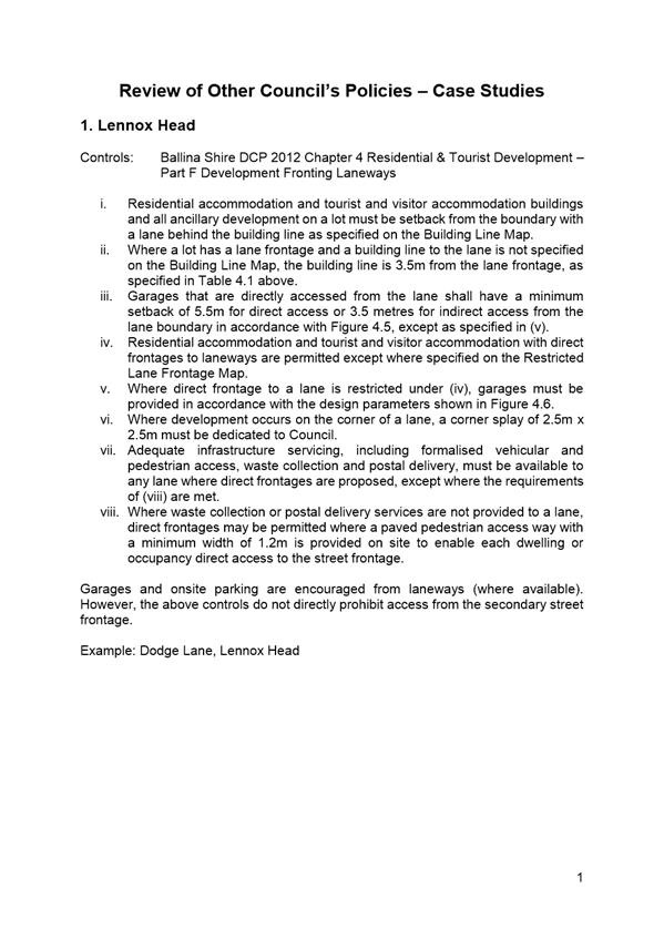
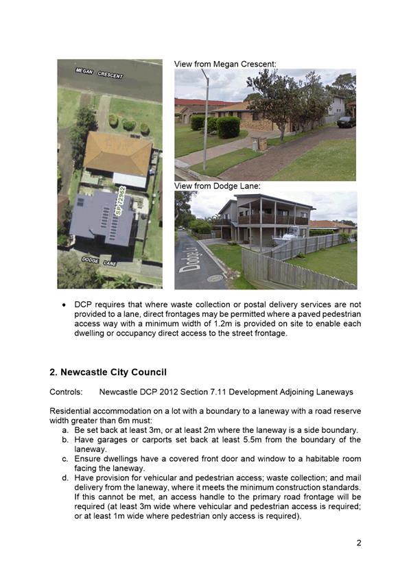
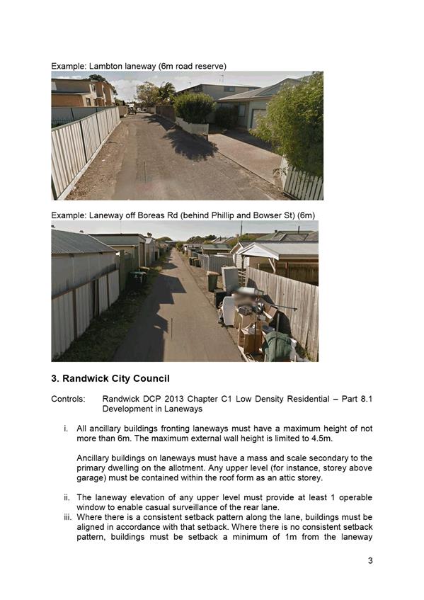
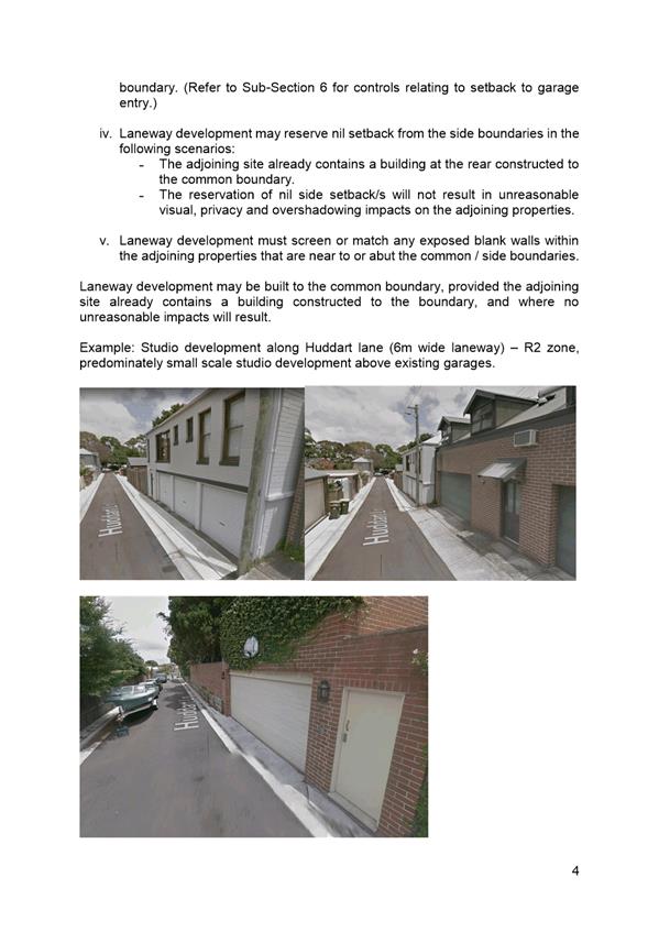
Three case studies from Ballina
Shire Council, Newcastle City Council and Randwick City
Council are included in Attachment 3, which provides a summary of
their respective DCP controls and examples of the resultant development form.
The three case studies highlight
a generally proactive approach to the management of development along laneways
as an emerging form of development in existing areas that needs to be
managed. Several issues can be effectively managed through a managed
approach to development as well as changes to the road environment such as
reduced speed limits, no parking signs and making laneways one way only.
In terms of NSW Government
policy, it is noted that SEPP (Affordable Rental Housing) 2009 allows a zero
setback to laneways for ‘secondary dwellings’ and ‘group
homes’ for up to 50% of the length of the boundary, where laneways are
defined as “a public road, with a width greater than 3m but less than 7m,
that is used primarily for access to the rear of premises, and includes a
nightsoil lane.” Depending on the future take up of complying
development, this has the potential to influence the existing use and character
of existing laneways in Shoalhaven.
Proposed Amendment -
Shoalhaven Development Control Plan 2014
In accordance with
Council’s resolution, a review of Shoalhaven DCP 2014 was also undertaken
to identify any gaps in planning policy in relation to development adjoining
narrow laneways. Shoalhaven DCP 2014 does not currently provide any
specific controls in relation to development fronting onto narrow laneways,
other than some specific examples.
It is recommended that
Shoalhaven DCP 2014 be amended to insert specific controls for development
fronting on to narrow laneways. The amendment will seek to manage
potential issues and provide a consistent policy approach to set backs and
frontages, infrastructure servicing, pedestrian safety, entering and existing
driveways, lighting and surveillance, character and existing residential
amenity, waste collection, sight lines on corner lots, traffic and car parking.
The objectives of the proposed
amendment will be:
· To
respond positively to the pressure for the introduction of dwellings fronting
onto laneways;
· To
ensure development is compatible with the characteristics of laneways and
existing residential character;
· To
ensure any buildings fronting laneways have a scale and mass secondary to the
main dwelling on the lot, or parent lot, and is appropriate to the width of the
laneway;
· To
promote casual surveillance and improve the safety and security of laneways;
and
· To
ensure development fronting laneways has safe and practical access and
appropriate infrastructure servicing.
At this stage the controls are
recommended to be included as part of a Generic Chapter amendment, as the
controls relate to specific development types that occur across
Shoalhaven. Should amendments to other chapters be required, these will
be included as part of the exhibition package for community consultation.
It is recommended that this
approach be supported so that the draft amendment can be formally
prepared. A further report will be provided to Council to enable
consideration of the draft amendment to the DCP.
Community Engagement
As detailed earlier in this
report, the proposed interim policy was publicly exhibited for a period of 30
days, from 11 April until 11 May 2018, inclusive. In addition to
newspaper and online advertising, Council wrote to over 650 landowners
adjoining a narrow laneway, with a short survey to seek direct feedback from
landowners. Internal consultation has also occurred with relevant Council
staff.
Any future amendment to
Shoalhaven DCP 2014 will also involve further consultation with relevant
stakeholders and the broader community in accordance with the Environmental
Planning & Assessment Regulation 2000.
Policy Implications
This project is a current,
non-priority project identified in the 2018-2019 Strategic Planning Works
Program.
The adoption of the
recommendation will result in a future amendment to Shoalhaven DCP 2014 and the
addition of this project to the Works Program.
Financial Implications
This project is, and will be
managed, within the existing Strategic Planning Budget.
Risk Implications
Without suitable development
controls in place, there is a risk of uncontrolled development occurring along
laneways. The amendment will seek to manage potential issues and provide
a consistent policy approach to future development adjoining narrow laneways.
|

|
Development
Committee – Tuesday 06 November 2018
Page
0
|
|

|
Development
Committee – Tuesday 06 November 2018
Page
0
|
|
|
Development
Committee – Tuesday 06 November 2018
Page
0
|
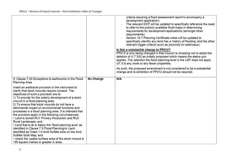
DE18.70 Exhibition
Outcomes and Proposed Finalisation - Review of LEP and DCP Flood Controls
HPERM Ref: D18/238835
Group: Planning
Environment & Development Group
Section: Strategic
Planning
Attachments: 1. Planning
Proposal PP0012 - Review of Flood Controls (under separate cover) ⇨
2. Draft
DCP Chapter G9: Development on Flood Prone Land (under separate cover) ⇨
3. Draft
DCP Chapter G9: Supporting Maps (under separate cover) ⇨
4. Draft
DCP Chapter G10: Caravan Parks in Flood Prone Areas (under separate cover) ⇨
5. Draft
DCP Dictionary (under separate cover) ⇨
6. Submission
Summary - Draft DCP Amendment No. 8 Flood Related Development Controls -
Submission Summary ⇩
7. Post Exhibition Table of
Changes - PP012 ⇩
Purpose / Summary
Report the outcomes of the combined public exhibition of
Planning Proposal 012 (PP) – Review of flood controls and Shoalhaven
Development Control Plan (DCP) 2014 – Draft Amendment No. 8 - Flood
related development controls and to enable the LEP and DCP amendments to
proceed to finalisation.
|
Recommendation
(Item to be determined under delegated authority)
That Council:
1. Adopt
and finalise Planning Proposal (PP012) with a minor amendment being the
retention of the existing Clause 7.3(5) definition in Shoalhaven Local
Environmental Plan 2014.
2. Progress
the draft amendment to Shoalhaven Local Environmental Plan 2014 by:
a. Forwarding
PP012 to Parliamentary Counsel to draft the resulting amendment to Shoalhaven
Local Environmental Plan 2014; and
b. The
resulting amendment to Shoalhaven Local Environmental Plan 2014 be made using
Council’s delegation.
3. Adopt
and finalise draft DCP Amendment No. 8 with the following amendments:
a. Amend
the Dictionary to:
· Update
the definition of Flood Planning Level definition to be consistent with
Shoalhaven Local Environmental Plan 2014.
· Add
the following definition for ‘flood free land’
Flood free land means land above
the probable maximum flood level.
· Be
consistent with changes made to the Dictionary by other recent amendments to
the DCP.
b. Amend
Draft Chapter G9 to:
· Update
the advisory note in Section 2 as outlined in this report.
· Reword
P3.1 as follows:
P3.1 The development (subdivision and intended
future use) is a suitable land use, and is adequately designed, for the
defined hazard/hydraulic category.
· Amend
the note in Schedule 2 to clarify that ‘existing use rights’ are
defined in the NSW Environmental Planning and Assessment Act 1979.
· Include
two new supporting maps for the Floodplain Risk Management Areas –
Riverview Road Area and Terara Village to clearly identify the land to
which relevant site-specific controls apply, remove the supporting map for
Lake Wollumboola, and reformat and reorder all the maps.
c. Amend
the Chapter G9 Supporting Document to insert the words “or with a local
planning consultant” after “Please check with
Council….”
d. Amend
Draft Chapter G10 to update the advisory note in Section 1 as outlined in
this report.
e. Update
all references to ‘Section 149 Planning Certificates’ to Section
10.7 Planning Certificates in both Draft Chapters G9 and G10 and all
supporting documents.
f. Make
general formatting changes to improve the readability of both Draft Chapters
G9 and G10 and all supporting documents.
|
Options
1. Adopt the
recommendation.
Implications: This will enable the PP to be
finalised within the required period set by the Gateway determination (by 11
December 2018) and Amendment No. 8 to the DCP to be made effective.
2. Adopt the PP and
DCP Amendment as exhibited.
Implications: This will result in a PP and DCP
amendment that is not supported by sections of Council and the OEH and does not
respond to the community submission received. Given that there would be an
outstanding State government agency objection to the PP, Council’s powers
to make the LEP amendment would need be relinquished to the DP&E for
decision making and the PP may not proceed.
3. Not proceed with
the PP or draft DCP Amendment.
Implications: The relevant provisions of Shoalhaven
Local Environmental Plan (LEP) 2014 and the Shoalhaven Development Control Plan
(DCP) 2014 will not be amended, and the existing outdated flood maps will
remain in Shoalhaven LEP 2014. This may compromise/complicate the ongoing
operation of Shoalhaven LEP 2014 and Shoalhaven DCP 2014.
Background
The PP is part of the ongoing housekeeping amendments aimed
at improving and continually updating the Shoalhaven LEP 2014. It seeks
to amend the flood related development controls in the LEP by:
· Removing the Flood
Planning Area Maps (Note: detailed flood mapping is now available on
Council’s website for public access);
· Addressing the
definition of Flood Planning Level (FPL); and
· Adding
development controls that require consent for ‘stock mounds’ on
flood prone land and areas affected by acid sulfate soils.
The Gateway determination for
the PP was granted on 8 June 2017 for a period of 12 months, with a subsequent
6-month extension granted until 11 December 2018. Council has delegated
authority to finalise the LEP amendment in this regard.
The associated Draft DCP Amendment seeks to amend the
existing Chapters G9 -Development on Flood Prone Land, G10 – Caravan
Parks in Flood Prone Areas and the DCP Dictionary to complement the changes
proposed in PP.
Public Exhibition
PP and draft DCP Amendment were
exhibited together for a period of 31 days from 23 May 2018 to 22 June
2018. Notices appeared in local newspapers on 23 May 2018.
All Community Consultative
Bodies (CCB’s) and local development industry representatives were
notified in writing. Internal groups within Council and relevant State
Government agencies were also advised. It is also noted that pre-exhibition
consultation was undertaken with internal groups of Council and relevant State
Government Agencies.
The exhibition package consisted
of the following:
· Planning
Proposal (PP012) – Flood related development controls, dated May 2018 (Attachment
1).
· Gateway
determination dated 8 June 2018.
· Draft
DCP 2014 Amendment No. 8 Chapter G9 Development on Flood Prone Land (Attachment
2) and supporting maps (Attachment 3).
· Draft
DCP 2014 Amendment No. 8 Chapter G10 Caravan Parks in Flood Prone Areas (Attachment
4).
· DCP
2014 Amendment No. 8 – Dictionary (Attachment 5).
· Explanatory
Statement.
Community and External
Stakeholder Feedback
No issues raised by the
community or industry representatives in relation to the PP.
One (1) submission was received
from a local consultancy in relation to the draft DCP, which advises that the
proposed changes are generally positive in nature and clarify areas of
uncertainty. It provides detailed comments on aspects of the DCP and related
matters. The contents of the submission are summarised in Attachment 6
and a copy of the actual submission will be available in the Councillors room
prior to the meeting.
In response to the submission,
it is intended to make the following changes to the exhibited Amendment No.8 to
the DCP:
|
Section
|
Proposed change
|
|
Dictionary
|
· Amend
the definition of ‘Flood Planning Level’ (FPL) to be consistent
with Shoalhaven Local Environmental Plan 2014
· Add
the following definition for ‘flood free land’:
Flood free land means land above
the probable maximum flood level.
· Other
require consistency changes.
|
|
Section
|
Proposed change
|
|
Chapter G9
|
· Reword
new Performance Criteria P3.1 to read as follows:
P3.1 The
development (subdivision and intended future use) is a suitable land use, and
is adequately designed, for the defined hazard/hydraulic category.
· Amend
the note in Schedule 2 to clarify that ‘existing use rights’ are
defined in the NSW Environmental Planning and Assessment Act 1979.
· Include
the supporting maps for Terara and Riverview Road, remove the supporting map
for Lake Wollumboola, and reformat and reorder all the maps.
|
|
Chapter G9 Supporting
Document
|
Insert the words “or with a local planning
consultant” should be inserted after “Please check with
Council….”
|
|
General
|
General formatting changes to
improve the readability of both Draft Chapters G9 and G10 and supporting
documents as suggested (see Attachment 6).
|
Government Agency and Internal
Feedback
Feedback was received from the
following government agencies on the exhibited package:
· NSW
Department of Primary Industries
· NSW
Office of Environment and Heritage (OEH)
· Water
NSW
Most feedback was supportive or
raised no issues. However, OEH and Council’s Environmental Services
Section raised some concerns regarding the intent of the PP, which are
summarised below:
· Deleting the
current Clause 7.3(5) FPL Definition (1:100 ARI + 0.5m freeboard) is
inconsistent with the NSW Floodplain Development Manual (FDM) 2005 and could
lead to differing interpretations of the FPL.
· Including a new
Clause 7.3A in relation to stock mounds may not adequately consider
‘other earthworks’ that are not stock mounds.
Further consultation with OEH
and Council’s Environmental Services Section resulted in an updated
proposed Clause 7.3(5) FPL definition being explored. However, OEH
was ultimately not supportive of this approach due to the potential for it to
also be inconsistent with the FDM (see Attachment 7). For Council to
pursue this approach, Council would have to relinquish its delegated powers
from the Minster for Planning and have the Department of Planning and
Environment (DP&E) decide how to proceed. As the main intention of
the PP was to remove the flood maps from the LEP, OEH’s position was
agreed to by staff to enable the PP to progress. Thus, it is recommended that
the existing Clause 7.3(5) definition be retained in the LEP.
Conclusion
· Planning
Proposal
To enable Council to adopt and
finalise the PP, it is recommended that the PP be amended to maintain the
Clause 7.3(5) definition of Flood Planning Level in Shoalhaven LEP 2014
as it currently exists:
Flood Planning Level
means the level of a 1:100 ARI (average recurrent interval) flood event plus
0.5 metre freeboard.
This amendment is considered
minor in nature and re-exhibition of the PP is not required. This has been
confirmed by DP&E. Once adopted the final PP can be provided to the
NSW Parliamentary Counsel to enable the drafting of the amendment to Shoalhaven
LEP 2014. Council has authority to carry out the functions of the
Minister in relation to the making of the LEP Amendment.
Future investigation may be
required into how ‘earthworks other than stock mounds’ on flood
prone land are addressed in Shoalhaven LEP 2014. This is not within the
scope or intent of this PP - a future PP may be required, dependant on research
and future consideration of this issue, but this is not considered to be a
pressing issue to resolve.
· DCP
Amendment
To enable Council to finalise
and adopt Draft DCP Amendment No.8, it is recommended that the following minor
amendments be made as part of the finalisation process:
1. Amend the
Dictionary to:
a. Update the definition of
flood planning level (FPL) to be consistent with Shoalhaven LEP 2014.
b. Add the following definition
for ‘flood free land’
Flood free land means
land above the probable maximum flood level.
c. Be consistent with changes
made to the Dictionary by other recent amendments the DCP.
2. Amend Draft
Chapter G9 to:
a. Update the advisory note in
Section 2 as shown below (additions identified as
such for the purposes of this report only):
|
Advisory Note: In addition to the provisions outlined in this
Chapter, you must refer to the supporting documents/checklists/maps:
o Supporting Document 1: Chapter G9 – Guidelines
for Development on Flood Prone Land.
o Supporting Maps: Site Specific Areas
o Council’s online interactive flood mapping
portal.
Flood Prone Land: is all land at or below the Probable
Maximum Flood event level and is described in detail in
supporting Document 1 under the heading of Flood Planning Concepts in
Schedule 5
There are a
number of catchments within the Shoalhaven that have not been subject of a
detailed flood study. Any works proposed within such an area must
therefore be accompanied by a flood assessment report – refer to
Supporting Document 1: Chapter G9 – Guidelines for Development on Flood
Prone Land for more information. It is noted that if a flood assessment
report identifies land to be at or below the Flood Planning Level (FPL) then
Clause 7.3 of Shoalhaven LEP 2014 will also apply to development on that
land. FPL is defined in the DCP Dictionary and Shoalhaven LEP 2014
Dictionary.
In cases where the site
is classified as partially flood affected, it is strongly recommended to only
consider development on the flood free portion of the allotment.
|
b. Reword Performance Criteria
P3.1 as follows:
P3.1 The development (subdivision
and intended future use) is a suitable land use, and is adequately designed,
for the defined hazard/hydraulic category.
c. Amend the note in Schedule 2
to clarify that ‘existing use rights’ are defined in the NSW
Environmental Planning and Assessment Act 1979.
d. Include two new supporting
maps for the Floodplain Risk Management Areas – Riverview Road Area
and Terara Village to clearly identify the land to which relevant site
specific controls apply, remove the supporting map for Lake Wollumboola, and
reformat and reorder all the maps.
3. Amend the
Chapter G9 Supporting Document to insert the words “or with a local
planning consultant” should be inserted after “Please check with
Council….”
4. Amend Draft
Chapter G10 to update the advisory note in Section 1 of as outlined in this
report shown below (additions identified as such
for the purposes of this report only):
|
Advisory Note: In addition to the provisions outlined in this
Chapter, you must refer to the supporting documents/checklists/maps:
o Supporting Document 1: Chapter G10 –
Guidelines for Caravan Parks in Flood Prone Areas
o Supporting Maps: Site Specific Areas and
o Council’s online interactive flood mapping
portal.
There are a
number of catchments within the Shoalhaven that have not been subject of a
detailed flood study. Any works proposed within such an area must
therefore be accompanied by a flood assessment report – refer to
Supporting Document 1: Chapter G10 – Guidelines for Caravan Parks in
Flood Prone Areas for more information. It is noted that if a flood
assessment report identifies land to be at or below the Flood Planning Level
(FPL) then Clause 7.3 of Shoalhaven LEP 2014 will also apply to development
on that land. FPL is defined in the DCP Dictionary and Shoalhaven LEP
2014 Dictionary.
Manufactured home
estates, caravan parks and camping grounds will all be referred to as caravan
parks from here on.
|
5. Make minor
formatting etc. changes as identified in the submission received.
These amendments are minor in
nature and re-exhibition of the resultant draft DCP Amendment No. 8. is not
required.
Policy
Implications
Progressing
these amendments will mean that the most up-to-date flooding information
applies to development in flood prone areas.
Financial
Implications
Finalisation of the PP and draft
DCP amendments will continue to be undertaken within the existing Strategic
Planning budget.
|
|
Development
Committee – Tuesday 06 November 2018
Page
0
|

|
|
Development
Committee – Tuesday 06 November 2018
Page
0
|
|

|
Development
Committee – Tuesday 06 November 2018
Page
0
|
DE18.71 Draft
Planning Agreement – Lot 172 DP 755923 and Lot 823 DP 247285 Berringer
Rd, Cunjurong Point Rd and Sunset Strip Manyana
DA. No: SF9787-02
HPERM Ref: D18/347434
Group: Planning
Environment & Development Group
Section: Development
Services
Attachments: 1. Voluntary
Planning Agreement (Draft) - Shoalhaven City Council & Ozy Homes Pty Ltd
- Lot 172 DP 755923 Cunjurong Point Rd Manyana (under separate cover) ⇨
2. Explanatory
Note - Voluntary Planning Agreement - Shoalhaven City Council & Ozy Homes
Pty ~ Lot 172 DP 755923 Cunjurong Point Rd, Manyana ⇩
3. Report to Development
Committee 7/7/09 - Strategic Planning & Infrastructure ⇩
Description of Development: Draft Planning
Agreement associated with a 182 lot residential subdivision
Owner: Manyana Coast Pty Ltd
Applicant: Ozy Homes Pty Ltd
Notification Dates: Draft Planning Agreement and
Explanatory Note publicly exhibited 12 September - 10 October 2018
No. of Submissions: nil in objection
four in
support
Purpose / Reason for consideration
by Council
At the Ordinary Meeting of
Tuesday 14th July 2009, it was resolved that:
a) Council
accept the additional development contributions as detailed in the consent
issued by the Minister for Planning to Malbec Properties and Manyana Estates
Pty Ltd subdivision of Lot 172 DP 755923 and Lot 823 DP 247285, and commence
the process to enter a Voluntary Planning Agreement with Malbec Properties and
Manyana Estates Pty Ltd;
b) Council
require Malbec Properties and Manyana Estates Pty Ltd to design and cost the
intersection upgrade of Bendalong Road and Inyadda Drive, Manyana as a
requirement of the Voluntary Planning Agreement;
c) Council
negotiate with Vacenta (proposed developer of Lot 810
DP 247285, Lot 705 DP 613881 & Lot 682 DP 568678) on identical
development contributions approved by Minister for Planning for Malbec
Properties and Manyana Estates Pty Ltd (Lot 172 DP 755923 and Lot 823 DP
247285) on a pro-rata basis; and
d) Any Voluntary Planning Agreement be consistent
with Council’s Voluntary Planning Agreement Policy and template with
costs of preparing Agreements borne by the Developer.
The draft Planning Agreement
(PA) (refer to Attachment 1) and Explanatory Note (EN) (refer to Attachment
2) have been publicly exhibited and are being reported to the Development
Committee for final consideration.
|
Recommendation (Item to be determined
under delegated authority)
That in accordance with the
Committee’s delegated authority from Council, the Committee endorse the
draft Planning Agreement between Shoalhaven City Council and the developer
(Ozy Homes Pty Ltd) of Lot 172 DP 755923 Cunjurong Point Rd and Lot 823 DP
247285 Sunset Strip Manyana which was publicly exhibited from 12 September
– 10 October 2018.
|
Options
1. Resolve to endorse
the draft PA and therefore adopt the recommendation of this report (preferred
option).
Implications: Endorsement of the draft PA
would satisfy Condition B28 of development consent MP05_0059 (SF9787) (This
condition is reproduced later in this report).
Once the terms of the PA have been met (i.e. the PA is signed by both
parties and payment is made by the Developer to Council), a Construction
Certificate would be able to be issued (subject to compliance with all other
relevant conditions of consent).
2. Resolve to
modify the recommendations as contained in this report and/or request
amendments to the draft PA.
Implications: Council will need to provide further direction
to staff.
Figure
1 - Location Map

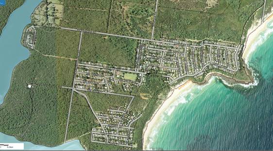
Figure
2 - Detailed Location Map

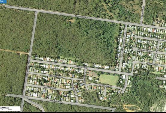
Background
Malbec Properties and Manyana Estates Pty Ltd (Malbec)
were granted development consent on 8th July 2008 by the Minister for Planning
(the Minister) for a 182 residential lot subdivision at Manyana (Council
Subdivision Reference SF9787).
Prior to the
determination by the Department of Planning (the Department), Malbec and
Council had been negotiating development contributions to be paid by Malbec to
Council. In addition to development contributions required under
Council’s then 1993 Contributions Plan, the Department agreed that Malbec
should make additional contributions.
Malbec and
Council made separate submissions to the Department over the nature of these
additional contributions, with the Department determining what the Minister
should consider. These discussions were previously reported to Council on 14th
April 2007 and 24th July 2009. (refer to Attachment 3)
The
Minister’s consent for the Malbec proposal did not fully capture
Council’s request for additional contributions. It is noted that all the
contributions required under Council’s Contributions Plan were included
as a condition of consent.
Condition
B28 of the consent, issued on 8th July 2008, required the developer
to enter into a Voluntary Planning Agreement with Council prior to the issue of
a Construction Certificate. The agreement to specifically provide for the works
and costs outlined in the table below:
Table 1 – Additional Contributions to be included
in the Voluntary Planning Agreement
|
Item
|
Description
|
Amount
|
|
1
|
Extension of Community Hall,
Yulunga Reserve
|
$36,134.00
|
|
2
|
Upgrade Foreshore Facilities,
Including the Provision of Car Parking
|
$15,265.00
|
|
3
|
Upgrade Works to Bendalong
Road and Inyadda Drive
|
$56,160.00
|
|
4
|
Construction of a Rural Road
Type B Intersection, Bendalong Road and Inyadda Drive
|
$12,721.00
|
|
Total
|
|
$120,280.00
|
At the Ordinary Meeting of Tuesday 14th July
2009, it was resolved that:
a) Council
accept the additional development contributions as detailed in the consent
issued by the Minister for Planning to Malbec Properties and Manyana Estates
Pty Ltd subdivision of Lot 172 DP 755923 and Lot 823 DP 247285, and commence
the process to enter a Voluntary Planning Agreement with Malbec Properties and
Manyana Estates Pty Ltd;
b) Council
require Malbec Properties and Manyana Estates Pty Ltd to design and cost the
intersection upgrade of Bendalong Road and Inyadda Drive, Manyana as a
requirement of the Voluntary Planning Agreement;
c) Council
negotiate with Vacenta (proposed developer of Lot 810
DP 247285, Lot 705 DP 613881 & Lot 682 DP 568678) on identical
development contributions approved by Minister for Planning for Malbec
Properties and Manyana Estates Pty Ltd (Lot 172 DP 755923 and Lot 823 DP
247285) on a pro-rata basis; and
d) Any Voluntary Planning Agreement be consistent
with Council’s Voluntary Planning Agreement Policy and template with
costs of preparing Agreements borne by the Developer.
Regarding
the resolution above the following comments are made:
a) A review of the file indicates that the
process to enter into the PA with the developer did not proceed at that time.
b) The condition of consent for the PA
is a set monetary contribution for specific works and does not require the
developer to undertake design work or permit Council to attribute additional costs
associated with the intersection upgrade works.
c) This component of the resolution is
not relevant to the PA.
d) The PA has been prepared in accordance with the Council
Policy with the cost of preparing the PA borne by the developer.
Draft Planning Agreement Overview
In December
2017 the developer contacted Council to discuss the steps required to commence
the PA process. Following numerous discussions with staff a draft PA and EN
were developed. The wording of the draft PA and related EN were agreed upon by
Council’s Legal Services Coordinator in conjunction with the
developer’s lawyer. It complies with legislative requirements and is
consistent with the requirements of the development consent.
Consultation and Community Engagement:
The draft PA, EN and related
development consent MP05_0059 were placed on public exhibition from 12
September until 10 October 2018, in accordance with the requirements of
Council’s Community Consultation Policy (POL08/440), Voluntary Planning
Agreement Policy (POL08/417) and applicable clauses of the EP&A Act and
associated Regulation 2000.
Public
consultation / community engagement was as follows:
· Notification sent
to the Red Head Villages Association which is the Community Consultative Body
for the area;
· Advertised
in the local press (South Coast Register) on 12/9/18; and
· The documents were
available on the public access computers at the public libraries and
Council’s administrative buildings in Nowra and Ulladulla as well as on
Council’s website.
Four (4) submissions were
received. All four submissions supported the PA, though two submissions
requested that the contributions be used for purposes other than that
stipulated in the consent as detailed below.
Issue:
Two (2) submissions advise that
there is a long list of necessary maintenance and improvements to be made to
the hall which cannot be funded from income generated by facility use. They
request that the purpose of the contribution of $36,134 for the hall extension
is instead spent on maintenance and improvements to the existing hall or be
used to upgrade the playground equipment at the hall.
Comment
Council’s Asset Management
Unit and Community and Recreation Unit have advised that maintenance issues raised
in the submisison will be addressed within operational budgets, in liaison with
Community and Recreation Unit staff. Scoping of extension works will be
considered in consultation with Management Committee and user groups.
It is important to note that the
condition is specific in that the contribution is for extension to the
community hall. Therefore, the contribution cannot be used for maintenance works
or improvements to other public facilities such as playground equipment.
Financial Implications
If Council resolves to support
the draft PA, it can be signed by the two parties. Council staff and
resources have already been required to review the information and facilitate
public exhibition of the draft PA. As per Council’s Voluntary
Planning Agreement Policy, all costs associated with drafting the PA (i.e.
legal costs) have been funded by the Developer and staff resources are not charged.
Summary and Conclusion
This report seeks to ensure
transparency of process in the consideration of the Developer’s offer to
enter into the PA. It is not proposed to change the PA which was publicly
exhibited.
The PA as exhibited is
considered acceptable and will provide a material public benefit for Council
and the community and is therefore recommended to be endorsed.
|

|
Development
Committee – Tuesday 06 November 2018
Page
0
|
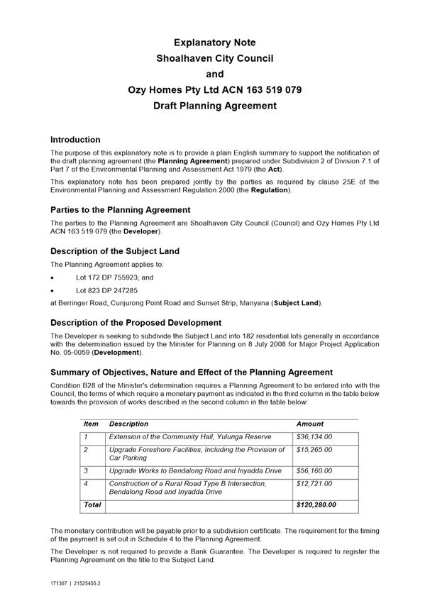
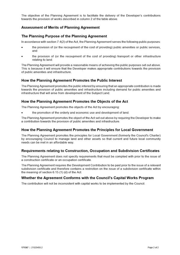
|
|
Development
Committee – Tuesday 06 November 2018
Page
0
|
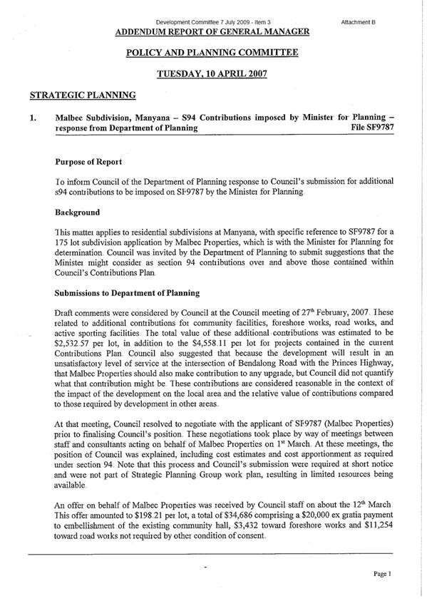
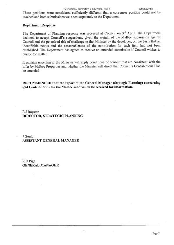
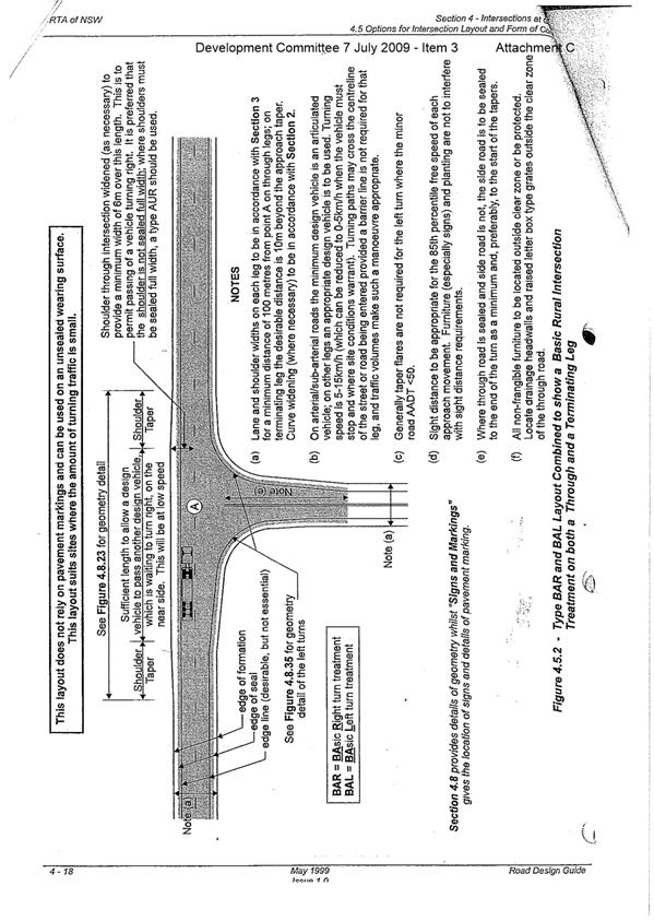
|
|
Development
Committee – Tuesday 06 November 2018
Page
0
|
DE18.72 Development
Application – 54 Eastbourne Ave, Culburra Beach – Lot 494 DP 12278
DA. No: DA17/2605/4
HPERM Ref: D18/352598
Group: Planning
Environment & Development Group
Section: Building
& Compliance Services
Attachments: 1. Applicant's
Objection Under SLEP Clause 4.6 - 54 Eastbourne Avenue Culburra Beach DA17-2605
⇩
Description of Development: Dwelling Alterations -
The proposed alteration is to enclose the existing unroofed deck area (3.5m x
9.36m) with high windows to create an enclosed habitable space.
Owner: S & C McNaughton
Applicant: iarchitecture
Notification Dates: 22 January 2018 – 6
February 2018
No. of Submissions: 1 in objection
0 in
support
Purpose
/ Reason for consideration by Council
Obtain direction from Council
regarding a request for a variation of a development standard (building height)
applicable to the site under clause 4.6 of Shoalhaven Local Environmental Plan
2014 (SLEP 2014).
Note: Requests for a variation
that exceed 10% of the development standard are required to be determined by
Council in accordance with the conditions of assumed concurrence by the
Secretary, NSW Department of Planning.
|
Recommendation
(Item to be determined under delegated authority)
That Council:
1. Confirm
that it supports, pursuant to clause 4.6 (exceptions to development
standards) of SLEP 2014, the applicant’s request to vary the height
limit of 7.5 metres to 9.08 metres; and
2. Refer
the development application (DA17/2605) back to staff for determination
|
Options
1. Resolve to
support the requested variation to the maximum height of buildings requirement.
Implications: This will permit the application to proceed in
its current form.
2. Resolve not to
support the proposed variation to the maximum height of buildings requirement.
Implications: This would result in the applicant needing to
reconsider the design of the proposal.
3. Resolve to
modify the recommendations contained in this report.
Implications: This would require the Committee to provide
direction to staff.
Figure 1 - Location Map
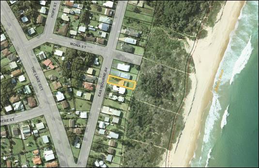
Background
Proposed Development
The application seeks approval to enclose an existing approved
roof deck to create a room of 32.76 m2. The area is currently
an open roof deck 6.77m x 9.36m. The proposed alteration is to enclose
3.5m x 9.36m of this deck with high windows to create an enclosed games room.
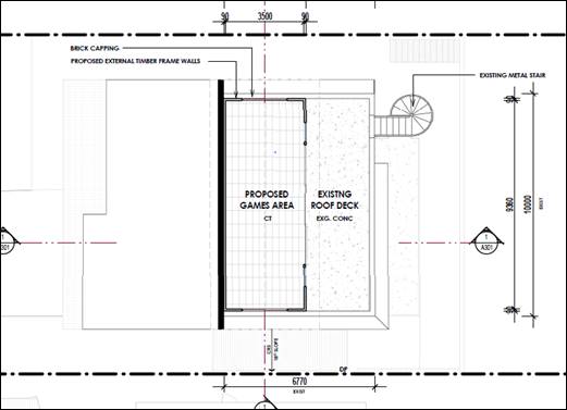
Figure 2:-
Proposed enclosure of the existing roof deck to form a games room.
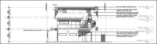
Figure 3:-
Proposed north east elevation.
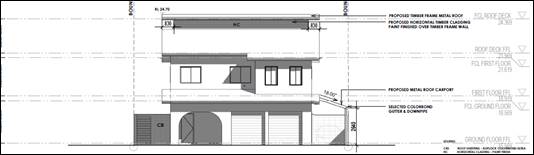
Figure 4:-
Proposed south west elevation.
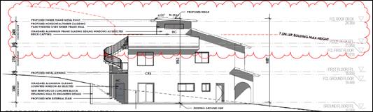
Figure 5:-
Proposed north west elevation.
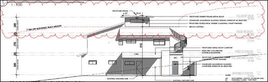
Figure 6:-
Proposed south east elevation.
Subject Land
The subject site is identified
as Lot 494, DP 12278, No.54 Eastbourne Avenue, Culburra Beach. The land
has a 15 metre frontage to Eastbourne Avenue, is regular in shape and has an
area of 822.02 m2. The site rises in elevation towards the Crown
Reserve towards Culburra Beach.
Site & Context
The development site has an
existing three level house located along the back of the coastal dune fronting
Warrain Beach. The house contains two enclosed levels plus an externally
accessed roof deck. The full brick building has concrete floors at each
of the three levels and the roof is tiled.
The land is zoned R2 –
Residential. The development in the immediate vicinity are residential
dwellings and these are predominantly two storey.
History of approvals
The existing dwelling was
approved under DA88/2043 on 27/06/1988 and a subsequent Building Application
(BA88/2793) was approved on 19/09/1988. The current building exceeds the
maximum height by 830 mm (i.e. it is 8.33 metres above existing ground
level). The proposal is to increase this current height by a further 750
mm to 9.08 metres above existing ground level.
Issues
Clause 4.3 (Height of
Buildings) of SLEP 2014.
Clause 4.3 relates to the
maximum height of buildings and the land is mapped as having a maximum height
limit of 7.5 metres above existing ground level. The development does not
comply with this development standard as the proposed games room will be 9.08
metres above the existing ground level. This is a further 750 mm above
the current roof level.
This represents a 21% variation
to the height limit (i.e. 1.58 metres).
Clause 4.6 (Exception to
development standards) of SLEP 2014.
The applicant has sought a
variation to the development standard pursuant to the requirements of clause
4.6 of the SLEP 2014.
The following is an extract from
the applicant’s justification for the variation of the development
standard:
“The proposal does not detrimentally affect
the shadowing of adjoining property. It does not disrupt views as the new
roof area will be within the width of the existing building. The proposal
will increase privacy by partially enclosing an upper level recreation
space. The proposal is consistent with the visual quality of the current
dwelling and with the neighbouring roof design characteristics. The
likely impact of the development will not differ noticeably compared with a
strictly complying development.
Discussion
In accordance with 4(a)(i) of
clause 4.6 of the SLEP 2014, the applicant’s written request is
considered to have adequately addressed the matter required to be demonstrated
by subclause (3), that is:
a) That compliance with
the development standard is unreasonable or unnecessary in the circumstances of
the case, and
b) That there are
sufficient environmental planning grounds to justify contravening the
development standard.
After reviewing the
applicant’s submission, it is considered that the variation is acceptable
for the following reasons:
· The
existing character of the area predominantly presents as large two storey
residential dwellings. The proposal presents as a two storey form with a
stepped ridge line. This is consistent with neighbouring residences;
· The
building height variation does not generate overshadowing impacts, loss of
views or loss of privacy on the surrounding properties;
· The
proposal will improve acoustic privacy, as it is proposed to enclose an
existing open balcony on the property;
· The
majority of the height, bulk and scale is already existing and the proposal
will not change the character of the existing building or the desired future
character of the locality.
· The
proposal is considered to be consistent with the objectives of the height
standard.
In accordance with subclause
4(a)(ii) of clause 4.6 of the SLEP 2014, the applicant’s written request
and associated plans are considered to have adequately demonstrated that the
proposed development will be in the public interest because it is consistent
with the objective of clause 4.3 and the objectives for development within the
R2 zone in which provide as follows:
4.3 Height of buildings
(1) The objectives of this clause are as follows:
(a) to ensure that buildings are compatible with
the height, bulk and scale of the existing and desired future character of a
locality,
(b) to minimise visual impact, disruption of
views, loss of privacy and loss of solar access to existing development,
(c) to ensure that the height of buildings on or
in the vicinity of a heritage item or within a heritage conservation area
respect heritage significance.
Zone Objectives
- To provide for the housing needs of
the community within a low density residential environment.
- To enable other land uses that
provide facilities or services to meet the day to day needs of residents.
- To provide an environment primarily
for detached housing and to ensure that other development is compatible with
that environment.
In accordance with the
departments guidelines for variations to development standards, Council should
consider the following 5 part test to identify if the application is well
founded:
a) The objectives of the
standard are achieved notwithstanding non-compliance with the standard;
The objectives of the height standard have been achieved as
the proposed games room is compatible with the height, bulk and scale of the
existing and desired future character of the locality while minimising visual
impact, disruption of views, loss of privacy and loss of solar access to
existing development.
b) The underlying
objective or purpose of the standard is not relevant to the development and
therefore compliance is unnecessary;
Due to the proposed setbacks, existing height of the
dwelling and minimal impact to the elevation visible from the public area, it
is considered that the underlaying objective of the height standard is not
relevant to the proposed variation.
c) The underlying object
or purpose would be defeated or thwarted if compliance was required and
therefore compliance is unreasonable;
The underlying objective or purpose
of the height control would not be defeated or thwarted if compliance is not
required. The objectives of the control will remain intact and available to
ensure compliance with other aspects as considered on a case-by-case basis.
Any future applications for this site will be subject to an
assessment against this control and may warrant compliance. Although the
proposal does not meet the numerical controls it is considered that it does
satisfy the objectives as discussed above and will not lead to a precedent that
undermined the objective of the control.
d) The development
standard has been virtually abandoned or destroyed by Council’s own
actions in granting consents departing from the standard and hence compliance
with the standard is unnecessary and unreasonable;
The development standard has not been abandoned or
destroyed in any form in this locality. Compliance with the standard is
considered unnecessary and unreasonable. The extent to which the proposal meets
the tests of the above provides sound justification for support of the
variation.
e) The compliance with
the development standard is unreasonable or inappropriate due to existing use
of the land and current environmental character of the parcel of land.
This is, the particular parcel of land should have been included in the zone.
This control is considered relevant and appropriate to this
site, locality and zone and compliance with the standard is unnecessary and
unreasonable. The extent to which the proposal meets the tests of the above
provides justification for support of the variation.
Under the terms of the
Secretary’s notification, Council can assume concurrence under clause
4.6(4)(b) but must give consideration to the matters in clause 4.6(5) of the
SLEP 2014:
a) Whether contravention
of the development standard raises any matter of significance for State or
regional environmental planning;
It is considered that the contravention of the maximum
building height development standard will not raise any matters of state or
regional planning significance in this case;
b) The public benefit of
maintaining the development standard;
The subject site already benefits from a height greater
than 7.5 metres from existing ground level. There is no public benefit in
maintaining the 7.5 metre height standard for this development as the variation
is minor in scale, well setback from boundaries and will not impact on views,
privacy or cause shade impacts to neighbours;
c) Any other matters
required to be taken into consideration by the Secretary before granting
concurrence;
No other matters required.
Planning Assessment
The Development Application
assessment under S4.15 of the Environmental Planning and Assessment Act 1979
will be finalised following determination of the application for variation to
development standards.
Consultation and Community
Engagement:
(1) submission was received in
relation to Council’s notification of the development. This submission is
by way of an objection to the development. The
notification was made in accordance with Council’s Community Consultation
Policy with letters being sent within a twenty five (25) metre buffer of the
site the notification was for a two week period.
Key issues raised as a result of
the notification are provided below.
Issue - The
extension will intrude into the view of the eastern sky including the sunrise
Comment - Despite the
property backing onto the Crown Reserve to Culburra Beach the surrounding
properties do not enjoy water views due to the contour of the land. The increase
in roof height by 725 mm will not affect the views of surrounding
properties. No significant views will be impacted upon. A reduction
in the view of the eastern sky line is not considered to be a significant view
line.
Issue - The
encroachment into the height limit will create a precedent which will see 5
storey buildings. Will end up living in complete shade.
Comment - Clause 4.6 of
the SLEP2014 allows for the owner of land to request a variation to a
development standard. This is a state wide clause in the standard
instrument and therefore it is not appropriate to deny land owners the
opportunity to request a variation. Each variation is considered on its
merit and therefore this application will not create a precedence.
Shadow diagrams were also
provided with the application that demonstrated that the proposal will not
significantly reduce the sunlight available to adjoining properties.
Financial Implications:
Nil
Legal Implications
If the application is refused,
or if the applicant is dissatisfied with Council’s determination, the
applicant is entitled to appeal to the Land and Environment Court.
Summary and Conclusion
It is considered that the
variation is reasonable and acceptable and strict compliance with the
development standard is considered to be unnecessary as the development is
appropriate in the location and can achieve the relevant planning objectives.
There
are sufficient planning grounds to justify the departure from the maximum
building height development standard prescribed in the Shoalhaven LEP
2014. The proposed variation is well founded in this instance and should
be approved.
|
|
Development
Committee – Tuesday 06 November 2018
Page
0
|
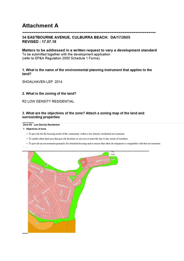
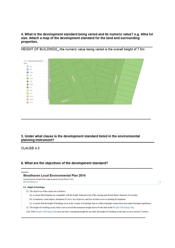
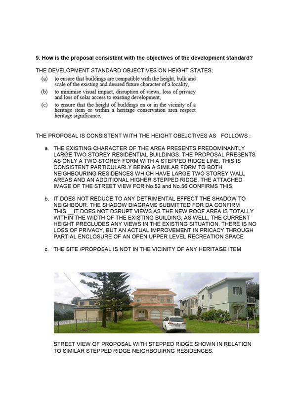
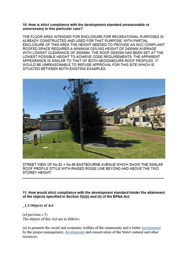
|
|
Development
Committee – Tuesday 06 November 2018
Page
0
|
DE18.73 Exhibition
Outcomes - Draft Planning Proposal Guidelines 2018
HPERM Ref: D18/355726
Group: Planning
Environment & Development Group
Section: Strategic
Planning
Attachments: 1. Draft
Planning Proposal (Rezoning) Guidelines 2018 (under separate cover) ⇨
2. Report
to May 2018 Development Committee - Draft PP Guidelines ⇩
3. Survey Results Report -
Community Engagement - PP Guidelines 2018 ⇩
Purpose / Summary
Report the results of the recent
community engagement on the draft Planning Proposal (PP) (Rezoning) Guidelines,
2018 (Attachment 1) and recommend their adoption.
|
Recommendation
(Item to be determined under delegated authority)
That Council:
1. Adopt
the Planning Proposal (Rezoning) Guidelines 2018 as exhibited and repeal the
2013 version of these guidelines.
2. Advise
those who made a submission during the exhibition of these guidelines of this
resolution.
|
Options
1. Adopt the draft
guidelines as exhibited.
Implications: The proposed guidelines are
recommended for adoption without any changes.
2. Not the proceed
with the draft guidelines.
Implications: The current 2013 guidelines will
remain in place. The expanded provisions relating to specialist studies,
community engagement and other matters will not be adopted by Council and this
will not lead to an improved process.
3. Adopt the
guidelines with amendments.
Implications: If amendments are proposed the
implication of any changes would need to be considered.
Background
Council’s Development
Committee considered a report on proposed revisions to Council’s existing
Planning Proposal Guidelines on 8 May 2018. A copy of the report to that
meeting and the draft revised guidelines are provided as Attachment 2.
At the meeting it was resolved to:
1. Endorse the attached
draft revision to the Planning Proposal (Rezoning) Guidelines for public
exhibition.
2. Exhibit the draft
revision to the Planning Proposal (Rezoning) Guidelines in accordance with the
attached Community Engagement and Communications Strategy.
3. Receive a further
report to consider feedback received during the public exhibition period and
enable finalisation of the Guidelines.
Community Engagement
Consistent with the resolution
the draft guidelines were exhibited from 5 September to 5 October 2018.
The exhibition included advertisements in local newspapers, a direct mailout to
Council’s development industry liaison mailing list, an article in
Council’s community newsletter and information on Council’s
“Get Involved” website.
Four (4) submissions were
received. All of which were survey responses lodged via the “Get
Involved” website. The survey results summary report is provided as
Attachment 3.
The matters raised in these
submissions are summarised and commented on below:
|
Submission
|
Comment
|
|
How do you ensure that several one off PPs don't have
the cumulative effect of changing zoning for a wider area? Could a landowner
apply to have a residential urban block rezoned for multiple dwellings, where
that is currently not permitted? If that one-off rezoning is approved, it
could start a domino effect in an area which was not zoned in the Shoalhaven
LEP for multiple dwellings on one block?
|
The coordination and high-level planning for rezoning is
provided by Council’s existing planning strategies. This includes the
Growth Management Strategy and Structure Plans and Settlement Strategies.
The draft guidelines continue Council’s currently
adopted position that a PP should only proceed if it is consistent with an
adopted strategy or if it is minor or correcting a zoning anomaly. This
approach is also consistent with relevant NSW Government guidance on
PP’s.
|
|
More approvals of land
rezoning in already established urban areas
|
The draft guidelines continue Council’s currently
adopted position that a PP should only proceed if it is consistent with
strategy or if it is minor or correcting a zoning anomaly.
|
|
The guidelines require too
much community engagement.
|
The community engagement requirements in the draft policy
are aimed to ensure engagement is proportional to the potential impact and
complexity of the proposal. It provides appropriate opportunities for
community engagement. Formal requirements are also set in the Gateway
determination received for any PP.
|
|
The guidelines do not require
enough community engagement.
|
|
I think full public
consultation occurs too late in the process.
|
The draft guidelines include a framework for engaging with
the community at the beginning of the PP process. This engagement is in proportion
to the potential impact and complexity of the proposal. This is above the
requirements of the planning legislation and is intended to ensure the
aspirations and concerns of the community are heard as early as possible in
the process.
|
|
Must
be balanced, you can find environmental reasons to stop all land rezoning.
|
Environmental impact of a PP is assessed in accordance
with the environmental legislation. It is beyond the scope of these
guidelines to determine what constitutes an acceptable level of environmental
impact.
|
|
Need
to be genuine specialist studies and not "cut and paste" documents
prepared by junior staff members. There needs to be evidence that the authors
spend a minimum number of hours on the ground and the report is tailored to a
specific locality.
|
Specialist studies are assessed under standards set for
these reports by a variety of guidelines and laws of NSW and the
Commonwealth. The guidelines provide for additional measures, such as peer
reviews and Council management of proponent funded studies, to ensure the
quality of studies is acceptable.
Ultimately, the studies need to be satisfactory to
Council, the NSW Department of Planning and Environment and, potentially,
other government agencies.
There is also a public opportunity to review studies and
provide feedback in the public exhibition of PPs.
|
|
Community
engagement is paramount. There needs to be sufficient publicity at an early
stage.
|
The guidelines provide for community engagement at the
beginning of the PP process in most circumstances. This engagement is above
the requirements of the Act and is intended to ensure the aspirations and
concerns of the community are heard as early as possible in the process.
|
The draft guidelines, as exhibited, are generally consistent
with the expectations and wishes of the community. They will provide a more
certain framework for the management of PPs. There are no particular changes
that have been identified following the consideration of public submissions. As
such it is recommended that they be adopted as exhibited.
Policy Implications
The draft PP Guidelines contain
several policy positions to help ensure that PPs are managed consistently and
transparently. The specific policy positions adopted in the
guidelines are described in detail in the May 2018 report to Development
Committee attached to this report.
Financial Implications
The review of the PP Guidelines
is managed within the existing Strategic Planning Budget using existing staff
resources.
|

|
Development
Committee – Tuesday 06 November 2018
Page
0
|

|

|
Development
Committee – Tuesday 06 November 2018
Page
0
|
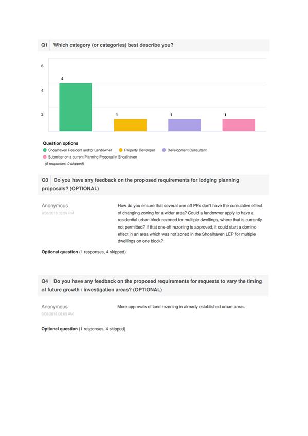
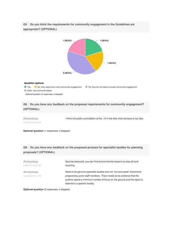

|
|
Development
Committee – Tuesday 06 November 2018
Page
0
|
Local Government Amendment (governance &
planning) act 2016
Chapter
3, Section 8A Guiding principles for councils
(1)
Exercise of functions
generally
The
following general principles apply to the exercise of functions by councils:
(a) Councils should provide strong
and effective representation, leadership, planning and decision-making.
(b) Councils should carry out
functions in a way that provides the best possible value for residents and
ratepayers.
(c) Councils should plan
strategically, using the integrated planning and reporting framework, for the
provision of effective and efficient services and regulation to meet the
diverse needs of the local community.
(d) Councils should apply the
integrated planning and reporting framework in carrying out their functions so
as to achieve desired outcomes and continuous improvements.
(e) Councils should work
co-operatively with other councils and the State government to achieve desired
outcomes for the local community.
(f) Councils should manage
lands and other assets so that current and future local community needs can be
met in an affordable way.
(g) Councils should work with
others to secure appropriate services for local community needs.
(h) Councils should act fairly,
ethically and without bias in the interests of the local community.
(i) Councils should be
responsible employers and provide a consultative and supportive working
environment for staff.
(2) Decision-making
The
following principles apply to decision-making by councils (subject to any other
applicable law):
(a) Councils should recognise
diverse local community needs and interests.
(b) Councils should consider social
justice principles.
(c) Councils should consider the
long term and cumulative effects of actions on future generations.
(d) Councils should consider the
principles of ecologically sustainable development.
(e) Council decision-making should
be transparent and decision-makers are to be accountable for decisions and
omissions.
(3) Community participation
Councils
should actively engage with their local communities, through the use of the
integrated planning and reporting framework and other measures.
Chapter
3, Section 8B Principles of sound financial management
The
following principles of sound financial management apply to councils:
(a) Council spending should be responsible and
sustainable, aligning general revenue and expenses.
(b) Councils should invest in responsible and
sustainable infrastructure for the benefit of the local community.
(c) Councils should have effective financial
and asset management, including sound policies and processes for the following:
(i) performance management
and reporting,
(ii) asset maintenance and
enhancement,
(iii) funding decisions,
(iv) risk management practices.
(d) Councils should have regard to achieving
intergenerational equity, including ensuring the following:
(i) policy decisions are made
after considering their financial effects on future generations,
(ii) the
current generation funds the cost of its services
Chapter
3, 8C Integrated planning and reporting principles that apply to councils
The
following principles for strategic planning apply to the development of the
integrated planning and reporting framework by councils:
(a) Councils should identify and prioritise key
local community needs and aspirations and consider regional priorities.
(b) Councils should identify strategic goals to
meet those needs and aspirations.
(c) Councils should develop activities, and
prioritise actions, to work towards the strategic goals.
(d) Councils should ensure that the strategic
goals and activities to work towards them may be achieved within council
resources.
(e) Councils should regularly review and
evaluate progress towards achieving strategic goals.
(f) Councils should maintain an
integrated approach to planning, delivering, monitoring and reporting on
strategic goals.
(g) Councils should collaborate with others to
maximise achievement of strategic goals.
(h) Councils should manage risks to the local
community or area or to the council effectively and proactively.
(i) Councils should make appropriate
evidence-based adaptations to meet changing needs and circumstances.